

AlpineQuest Explorer Lite
June 11, 2024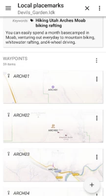
More About AlpineQuest Explorer Lite
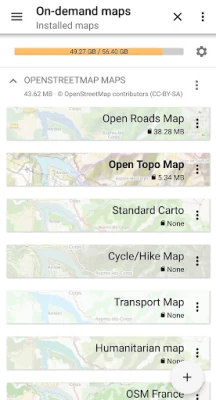
You can access and store locally a large range of on-line topographic maps, which will remain available even while being out of cell coverage. AlpineQuest also supports many on-board file-based raster map formats.
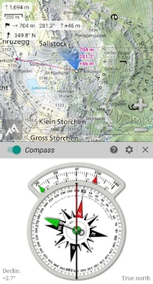
By using the GPS and the magnetic sensor of your device (with compass display), getting lost is part of the past: you are localized in real-time on the map, which can also be oriented to match where you are looking at.
Save and retrieve unlimited placemarks, share them with your friends. Track your path, get advanced statistics and interactive graphics. You won’t have anymore questions about what you can accomplish.
By staying fully operational out of cell coverage (as often in mountain or abroad), AlpineQuest assists you in all your desires of deep wilderness exploring…
Don’t hesitate, use this Lite version right now for free!
PLEASE report suggestions and issues on our dedicated forum https://www.alpinequest.net/forum (no registration needed, all questions answered) and not in comments.
Key features are (for full version):
★★ Maps ★★
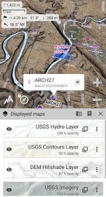
• Built-in online maps (with automatic local storage; road, topo and satellite maps included) and online layers (road names, hillshade, contours);
• Get more online maps and layers in one click from the included community maps list (all major worldwide maps and many local topo maps);
• Complete area storage of online maps for off-line use;
• On-board offline maps support (raster) including KMZ Overlays, OziExplorer OZFx2, OZFx3 (partly) and calibrated images, GeoTiff, GeoPackage GeoPkg, MbTile, SqliteDB and TMS zipped tiles (visit our website to get MOBAC, the free map creator);
• QuickChart Memory Map support (.qct maps only, .qc3 maps not compatible);
• Built-in image calibration tool to use any scan or picture as a map;
• Digital elevation model on-board storage (1-arcsec SRTM DEM) and support for HGT elevation files (both 1-arcsec and 3-arcsec resolutions) allowing display of terrain, hillshade and steep slopes;
• Polar maps (Arctic and Antarctic) support;
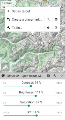
• Multiple maps in layers display, with per-map opacity/contrast/color/tint/blending control.
★★ Placemarks ★★
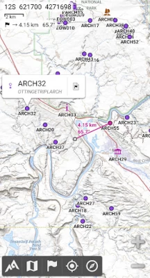
• Create, display, save, restore unlimited number of items (waypoints, routes, areas and tracks);
• Import/export GPX files, Google Earth KML/KMZ files and CSV/TSV files;
• Import ShapeFile SHP/PRJ/DBF, OziExplorer WPT/PLT, GeoJSON, IGC tracks, Geocaching LOC waypoints and export AutoCAD DXF files;
• Save and share online locations with other users using Community Placemarks;
• Details, advanced statistics and interactive graphics on various items;
• Time Controller to replay time-tagged tracks.
★★ GNSS Position / Orientation ★★
• On-map geolocation using device GNSS receivers (GPS/Glonass/Galileo/…) or Network;
• Map orientation, compass and target finder;
• Built-in GNSS/Barometric track recorder (long tracking capable, running in a separate and light process) with battery level and network strength recording;
• Proximity alerts and leave path alerts;
• Barometer support (compatible devices).
★★ And more ★★
• Metric, imperial, nautical and hybrid distance units;
• Latitude/Longitude and grid coordinate formats (WGS, UTM, MGRS, USNG, OSGB, SK42, Lambert, QTH, …) with on-map grids display;
• Ability to import hundreds of coordinate formats from https://www.spatialreference.org;
• …
Latest Version
2.3.8c
June 11, 2024
Psyberia
Travel & Local
Android
3,173,395
Free
psyberia.alpinequest.free
Report a Problem
User Reviews

A Google user
5 years ago
Useless. This app could serve as a demonstration of how to put users off and ensure they do not buy the paid version. Every time I try to load one of my maps, it says 'This feature is not available in the free version.' So I have no idea how they would display.
A Google user
5 years ago
Lite version 2.03 used to let you change QCT map. Later lite versions dont let you change the displayed map, it hangs instead ... on the page asking u to spend £6.

Angel Morales
2 years ago
Excellent maps. I use Alpine Quest to check up on other map apps because of its in-depth maps. Number one in my book!!

David Buckley
2 years ago
Footpaths appear, then disappear when you zoom in. Prefer Memory map with its standard OS format. Also it can all be downloaded so no need for 4G connection
A Google user
6 years ago
Very nice app. As a beginner I have a question: how to save my map including routes and check points on my SD card to be able to reuse them in case I uninstalled the app or formatted my Android device.

Meisam Rasouli
3 years ago
This app is literally useless because it doesn't even import kmz files. I am a geologist and I have to know the area that I am going to visit and the routes I have to take before going on a trip. With the app unable to import kmz or shp files I can't use it.

G BS
4 years ago
I don't like that I have to turn the phone off to get out of the app. The app navigation buttons are over the android home screen, back page, and open apps buttons.
A Google user
6 years ago
i haven't had a chance to utilize this map app in an outdoor environment, by downloading topo maps..But as far as it's operation and accuracy within my town, it works great. Thanks..

jean Marshall
2 years ago
We have alpine quest pro & alpine quest lite on 2 phones. Pro is fine as always. The lite will not grant permissions to access files on the phone since the last update so not much use. Please please restore this brilliant app to how it was.

Mark Kiehl
4 years ago
You cannot Import/export GPX files as stated. This feature is only for the paid version. I wanted to evaluate the functionality of the app for downloaded GPX tracks, but unable to. The app looks very functional otherwise.

Muktar Abanaga
1 year ago
Unable to import my data ,why?

David Deschamps
2 years ago
What a pity we cannot do anything with this free app. Downloaded it to try it before buying the pro version. But cannot try anything serious. Not even importi g a few waypoints or tracks. Bottom line will continue to search for another app.
A Google user
6 years ago
I always navigated in mountains with maps, but now I am using this amazing application, and leave map and compass as back up. It works perfect even in bad weather and fog. I recommend this useful hiking application.

Lakshmikant Bhatt
2 years ago
A very Good app for Trackers for Navigation, mapping purpose. I have to say that it is not giving good resolution (zoomed image) picture of the object at any specified location as we can see in Google maps image or Satellite map Image.

m f.tabrizi
4 years ago
Hi, I have tested this program with Ethernet turned off and in a place without network. It displays excellently and remembers all the specifications. You can be comfortable when this program is in your pocket.

Manuel Sidler
4 years ago
Great offline GPS tracking and navigation app. I use it to layout trails and treks for our Alpine club. Has all the maps you want with the ability to overlay and change opacity so you can mix satellite images with contour lines. I love it, I would definitely recommend.

C O
3 years ago
Having tested and explored this "lite" version, the paid pro app would seem to be the perfect replacement for Viewranger. It's far better, in fact. The single glaring problem is how to get UK Ordnance Survey Maps; but it *is* possible.

Sphenodon Punctatus
3 years ago
I found this app while looking for a replacement for Viewranger, which I've been using for many years. It is the best outdoor navigation app for Android bar none. Small, fast, and with an interface that is obviously designed by people that use it outdoors in anger on a daily basis. Highly recommended and the Pro version is well worth your money.

Gabriel Parodi
4 years ago
This is perhaps the best app for a hiker available in the market. I only found one problem during navigation. If the screen turns off for about 10 seconds, and you turn it on again, the GPS freezes in the last position. That is rather annoying. I tried letting work in the background, auto on, remove the battery saver. I could not solve the problem. Could it be possible to adapt the program in such a way that if the GPS slider is active, the program reactivates the GPS any time the screen is on?

B M
3 years ago
Best outdoor navigation app GAIA is pretty good and has more maps available (but that doesn't mean you can use all of them offline). But Alpine is lightweight and does everything you need. Buy the pro version and you can download maps for offline use. Pro version ships with basic maps. USGS Sattelite (meh, OK), USGS Topo, and some others. You can load GPS files onto this. TIP: Check out the windows program MOBAC for generating offline maps to use with this app. Highlyrecommend! !


